The past leaves clues all around us or, in the case of a UM-Dearborn archeology course, right under our feet.
A War of 1812 battlefield is just a few miles away from campus, and Associate Professor John Chenoweth brought his students there to learn more about the Native American and French inhabitants that lived on the land more than 200 years ago and what happened during the River Raisin conflicts.

“Most of those who lived here were illiterate, many spoke little English, and they were not the rich and powerful on whom history often focuses,” said Chenoweth, who teaches in the Anthropology program. “Our job as archaeologists is to recover the things they left behind so that we can tell their story.”
Students from UM-Dearborn and UM-Ann Arbor focused on the eighteenth-century River Raisin Settlement which was the site of the Battle of the River Raisin in January 1813. Chenoweth says the settlement was rebuilt across the river as the city of Monroe after the war leaving a “time-capsule” preserved for archaeologists.
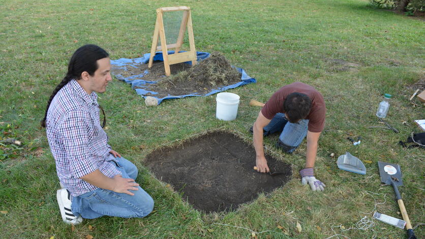
To learn more about the people and what occurred there, ANT 410: Archaeological Field School and Lab Methods students gathered their trowels, storage bags, line levels and more to excavate the site, identify artifacts and make records of their field work. UM-Dearborn is working with the City of Monroe and with River Raisin National Battlefield Park to aid in preserving and interpreting the site for the public.
Field school classes are often very expensive and require travel. To make the experience more accessible, Chenoweth created a course that offers field school experiences as part of an ongoing fall semester class where students go to the site once a week. “That makes it possible for many more people to try archaeological excavation, see what we do, and learn about how scientific research really works.”

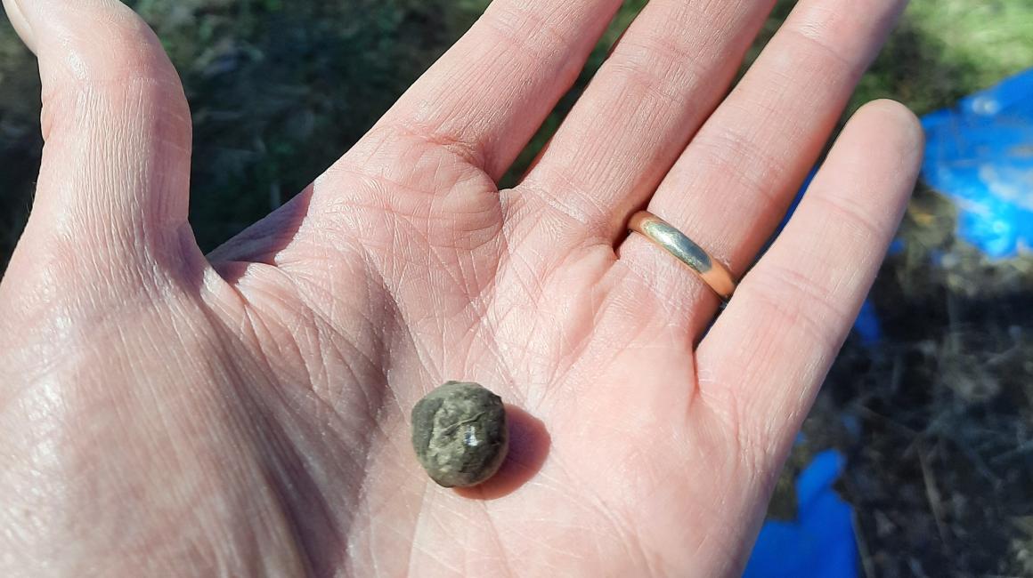
Anthropology major Will Smith said he and his course partner Mohan Karanth enjoyed their first field study experience. They found a pipe stem, ceramic shards and a rifle ball likely from the War of 1812 period during their excavation work in the class. “We mapped and bagged everything that looked interesting,” said Smith, a senior. “We joked that we were playing: Is this an artifact or is this a rock?”
Smith said the rifle ball just looked like a marble-sized stone at first. But when they picked it up, it was heavy and they knew it could have significance. They confirmed what it was after labeling their find and bringing it to the campus lab, where they used an X-ray fluorescence spectrometer to analyze its components.
Chenoweth said that find, along with another rifle ball found on the site, adds a layer to what is known about the conflicts at River Raisin. “We’ve recovered a rifle ball that likely only could have been fired by the U.S. Kentucky militia and clearly hit something. Its location suggests that they were engaged in close-range fighting, not the long-distance duel with the British troops the historical record emphasizes.”
Smith said he started as an engineering major, but switched to anthropology after learning the many ways that scientific research crosses over in the field to better understand people and their motivations. He said the field study — finding fragments of dishes, game pieces, artillery and more — is a reminder that people from the past were just like us.
“It’s easy to write off people from 200 years ago as being different from us. But they were like us — they had ideas, goals, families. And this is a reminder that these people were once here and died violently. I’m not trying to be morbid, but artifacts present situations as they were and don’t glorify them,” he said. “Through the data that’s gathered, it would be interesting if we can piece together an accurate account of what happened, without bias, and see how things came to be before the conflicts occurred. There are lessons from the past that can help us today and into the future.”
Sophomore Dalia Rabbah agrees. Rabbah isn’t studying anthropology or archeology, but she took the class because it looked interesting. As an Environmental Sciences major, she learned how applicable the lessons were in a variety of fields.
For example, hearing about someone’s culture helps you better understand people and perspectives. Doing detailed stratigraphic levels mapping is beneficial for geological studies, urban planning and architecture development. And, for Rabbah, seeing how GIS mapping is used will help her become a successful eco-climate researcher.
“At the same time we were learning about GIS mapping with our field study, I was in two classes that talked about it. In chemistry, we had a guest speaker who is an environmental chemist who uses GIS. And, in my weather and climate course, GIS mapping was discussed too. The techniques we used have wide application and my experience in the class will help me in the future.”
Rabbah said the research they had to do to identify the artifacts was intensive too. She said it went far beyond a Google search. They used labs, technology and some unorthodox sources.
“I found a lot of round clay items. I wasn’t sure exactly what they were, but I found a marble collector who offered to ID things with pictures. He told me that they were toys or game pieces from the early 1800s until the 1930s. He let me know that there were a lot of pottery workshops and toy companies in Northeastern Ohio at the time that hand rolled these items, set them out to dry, and made them in bulk,” Rabbah said. “I didn’t tell him where we found the artifacts or the time period I suspected, but what he told me fit in with other research we did that included peer-reviewed sources.”


