“Wireless is notorious for being a vulnerability,” says Professor of Electrical and Computer Engineering Samir Rawashdeh. “It’s hackable, devices come and go, and new sources of interference can appear at any time, and when something is going wrong, manufacturers need to quickly troubleshoot their networks. Generally, that means someone walking around with an antenna, which is expensive and time-consuming.”
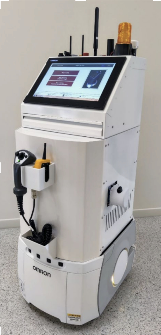
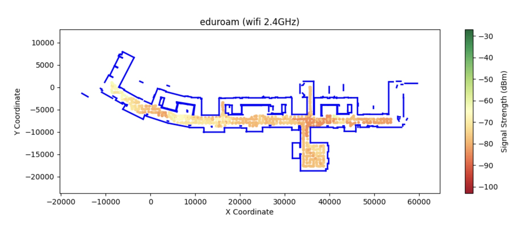
Rawashdeh is part of a UM-Dearborn-led team that has developed a better way — an autonomous, data-sniffing robot that can roll through a factory and generate a facilitywide heat map of every wireless network, including Wi-Fi, cellular LTE and 5G. The team, which also includes Junaid Farooq, Jaerock Kwon and Alireza Mohammadi, all associate professors of electrical and computer engineering, is funded by a $900,000 grant from digital manufacturing institute MxD.
Just as importantly, the robot is capable of ferreting out rogue data networks. So it’s likely to be a valuable tool for companies concerned with security vulnerabilities. The hip-high device gets its mobility from an off-the-shelf rolling platform manufactured by industrial automation company Omron. The platform was originally designed to trundle goods through warehouses, and Rawashdeh says reprogramming it for this exploration task, which it was not designed for, was a challenge.
Rawashdeh explains that the lidar-guided robot — lidar is a laser system that autonomous vehicles use to "see" their way around — is particularly useful in retooling situations, when engineers must figure out where to put wireless access points. It can also help pinpoint sources of interference, which can either come from an incidental source or a bad actor.
Both processes require a network map, which has traditionally meant workers trudging through factories with antennas each time a new tweak is made.
“With the robot, factory designers can make a tweak to the network, then turn on the robot at the end of the day to generate a new map overnight,” Rawashdeh says. “The next morning, they’ll know the effects of their changes. It’s much faster and less costly than having an employee survey the network during the workday.”
“The platform was originally made to go to one waypoint and stop, go to the next and stop and so on,” he says. “But we reprogrammed it to cancel a given waypoint when it was within a meter or so and go to the next one. So we were sort of tricking it into driving through a series of navigations rather than one at a time.”
Ultimately, the team developed software that enabled the platform to either navigate on its own or be steered by an operator using a joystick. The researchers partnered with Atlanta-based technology firm OPEX Systems to design the user interface, which enables operators to analyze and visualize the wireless maps produced by the robot.